A 7½-mile journey through local history

A tapestry of
time and place

Follow the former Sacramento Northern Railway from Lafayette to Moraga and discover nine stories written into the landscape.

Explore the trail ↓

Welcome

From mule trail to railway to regional trail

The Lafayette–Moraga Trail was used by mule trains in the 1800s to carry freshly milled redwood lumber. In 1913, the route became a railway line and joined the Sacramento Northern Railway.

After World War II, cars and trucks supplanted the railroad. In the 1970s, local communities partnered with the East Bay Regional Park District to create today’s paved, multi-use trail.

Lafayette to Valle Vista

The trail at a glance

Follow the historic rail corridor south through Lafayette and Moraga. Select any numbered marker to visit that stop.

Lafayette–Moraga History Trail mapA schematic north-to-south map of the trail with nine selectable history stops from Olympic Boulevard through Lafayette and Moraga to Valle Vista.LAFAYETTEMORAGAOLYMPIC BLVDST. MARY’S ROADVALLE VISTALafayette CreekCOMMUNITY CENTERST. MARY’S COLLEGEMORAGA COMMONSN123456789
Select a numbered stop to explore

Nine stories

Choose a stop

Travel north to south, or jump directly to any story.

  1. 1Reliez Station RoadTapestry of Time and Place
  2. 2Topper LaneLocal Commerce through Time
  3. 3Glenside DriveRapid Transit to Strolling, Rolling and Riding
  4. 4Lafayette Community CenterChanging Transportation
  5. 5Rheem Boulevard & St. Mary’s RoadEarly Inhabitants
  6. 6Saint Mary’s CollegeA Tradition of Persistence, Excellence and Transformation
  7. 7Moraga CommonsRanching: Shaping the Landscape through Time
  8. 8Moraga Country ClubLocal Agribusiness
  9. 9Valle VistaA Lost Community
Historic view near Reliez Station Road01

Stop 1Reliez Station Road

Tapestry of Time and Place

The quiet entrance to this trail masks its significant history and location. Follow this path that has for centuries linked Lafayette south to Moraga and farther still to the magnificent redwoods of Canyon. Like Highways 24 and 680 today, this trail has spurred economic, cultural and political connections between cities and villages west of the Oakland Hills to people and landscapes to the east.

First on foot, then by horse, then by rail until 1957, and ultimately by automobile, people continue to use this route to experience its stories and heritage.
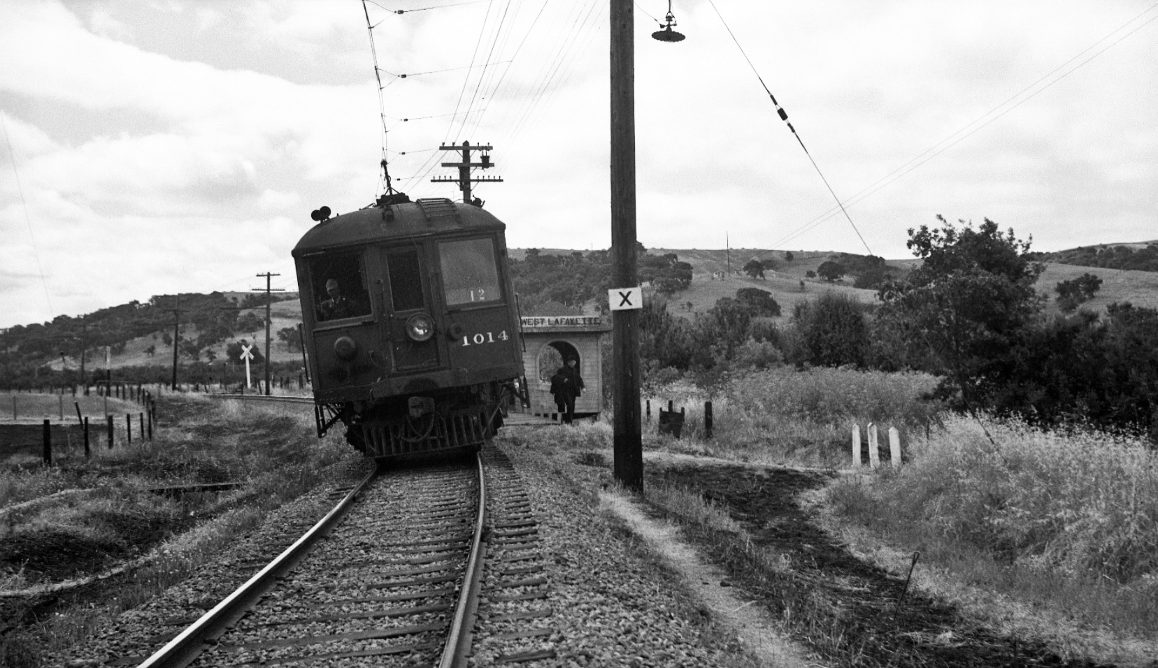
Sacramento Northern Railway at Topper Lane02

Stop 2Topper Lane

Local Commerce through Time

You are standing on a historical transit route that connected lumber mills in the Oakland hills with shipping ports in Martinez during the redwood timber boom of the mid-1800s. In 1847, Lafayette town founder Elam Brown acquired the 3,329-acre former Mexican land grant Rancho Acalanes, and others set up stores to serve locals and travelers, including Gold Rush “49ers.”

In 1913, electric trains began service along this trail, with multiple stops in Lafayette allowing local merchants to sell goods to settlers, farmers and ranchers. Now a popular recreation trail, this corridor continues to serve local residents and visitors.

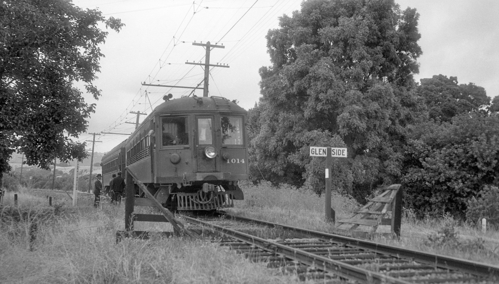
Historic electric passenger train near Glenside Drive03

Stop 3Glenside Drive

Rapid Transit to Strolling, Rolling and Riding

Passenger trains began rolling along this trail in 1913. By 1939, commuters could board the Sacramento Northern Railroad’s daily Comet and Meteor trains here at Glenside Drive and head directly to San Francisco via the lower-deck rails on the new Bay Bridge. The lines offered dining and parlor car service, operated at speeds up to 60 mph, and made the trip from San Francisco to Sacramento in less than three hours.

This was one of the longest interurban rail routes in North America, running from Chico to San Francisco, but costs outpaced revenues. The Bay Bridge, Caldecott Tunnel and improved roads reduced train ridership. Passenger service ended in 1941 and freight service in 1957. With the 1976 opening of the Lafayette–Moraga Regional Trail, transit returned—this time for pedestrians, bicyclists and equestrians.

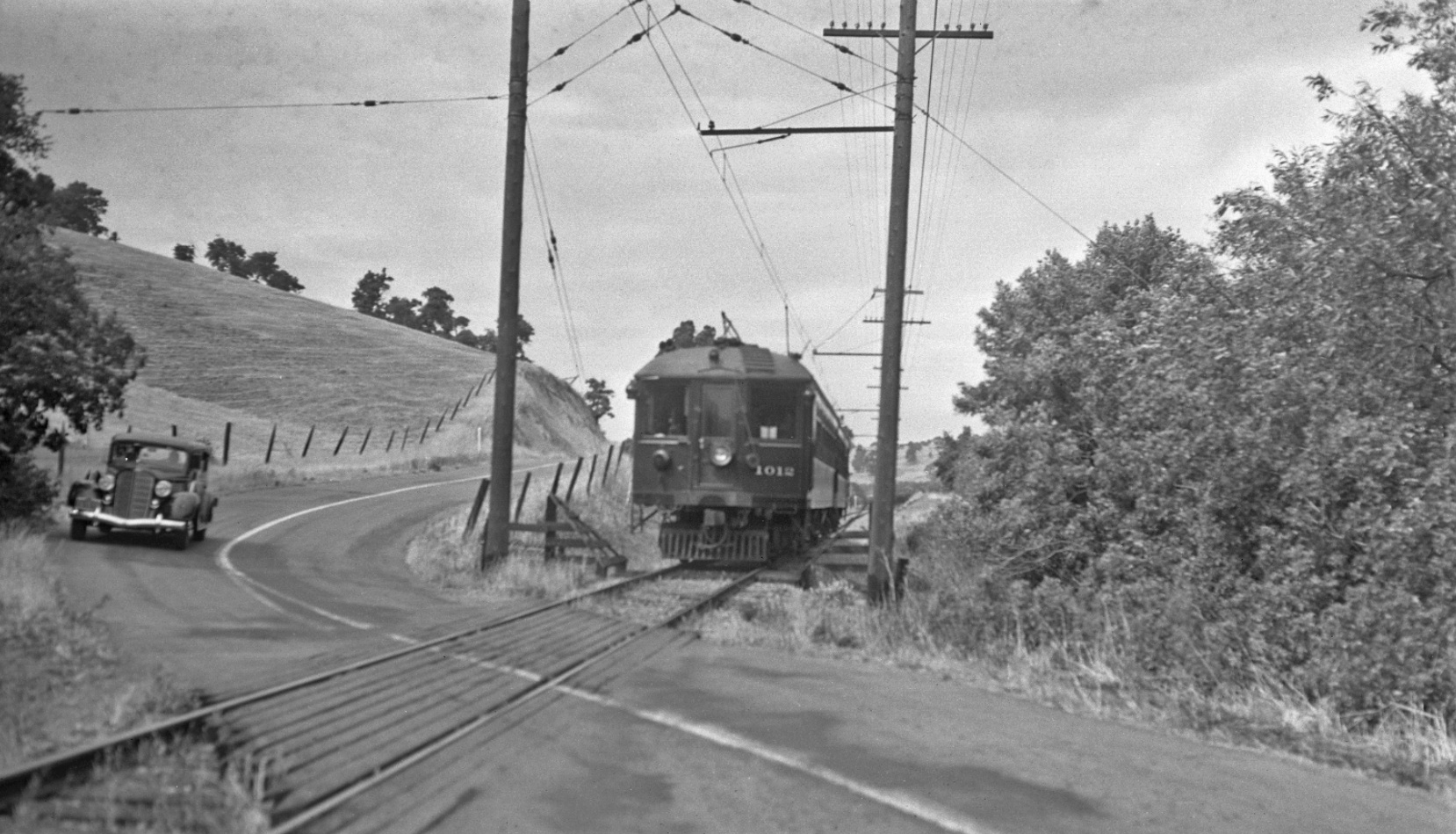
Historic Sacramento Northern Railway scene in Lafayette04

Stop 4Lafayette Community Center

Changing Transportation

Car ownership soared beginning in the 1920s. In the 1950s, transportation officials proposed a four-lane freeway along today’s Lafayette–Moraga Regional Trail. The “Shepherd Canyon Freeway,” or Highway 77, would exit a tunnel from Oakland, bisect Moraga Valley and Burton Valley, pass just feet from this spot and connect drivers to Highway 24.

The state planned to use eminent domain to clear the way. In 1972, after decades of community opposition and the start of BART service, the State Assembly removed the project from the State Highway Plan. In 1975, Caltrans removed Highway 77 from future consideration, bringing an end to the freeway that never was.

Historic train in the Moraga Valley05

Stop 5Rheem Boulevard & St. Mary’s Road

Early Inhabitants

Before you was once a vast inland sea. Over time, dynamic geology replaced the sea with hills and valleys. Marine snails, clams and sand dollars deposited here in the Moraga Valley can still be found. Footprints from prehistoric horses, amphibious rhinoceros and camels have been discovered.

Long after the sea had disappeared, fearsome short-faced bears, bison and mastodons also left their mark before their extinction 11,000–13,000 years ago, joining their predecessors in the fossil record.

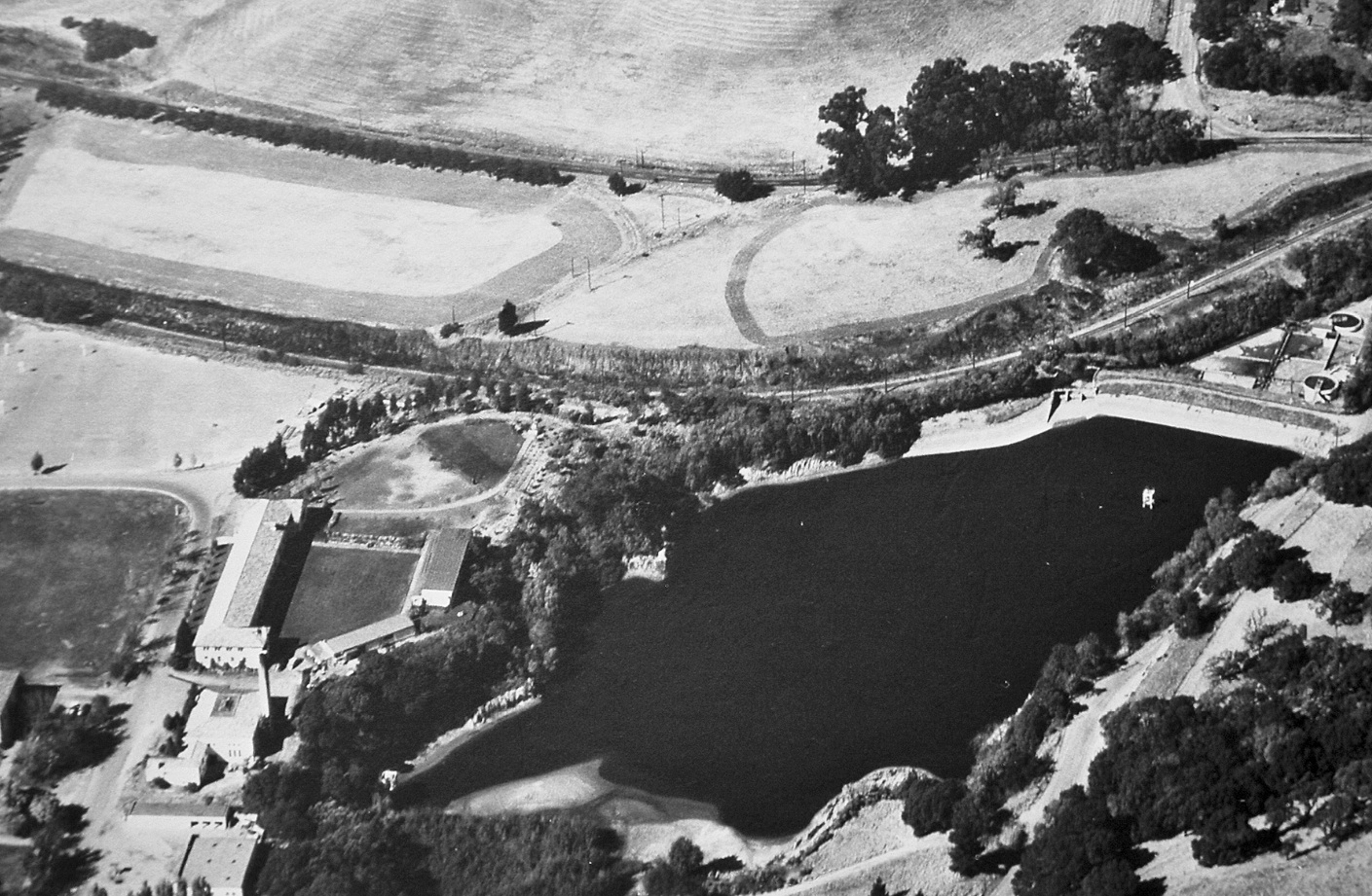
Historic view of Saint Mary’s College06

Stop 6Saint Mary’s College

A Tradition of Persistence, Excellence and Transformation

Saint Mary’s College came to Moraga in 1927 when the De La Salle Christian Brothers accepted land from James Irvine’s Moraga Company. Classes began in 1928 upon completion of the chapel and ten other buildings, all still in use today. The all-male college, famous for its academic rigor and celebrated football team, struggled financially during the Great Depression.

During World War II, the Navy used the campus for pre-flight training, stabilizing Saint Mary’s financially and adding municipal water, buildings and sports fields. The post-war GI Bill revitalized the student body. That transformation continued in 1970, when the school became coeducational. This persistent evolution belies Saint Mary’s stable presence as a local landmark.

Historic ranching landscape in Moraga07

Stop 7Moraga Commons

Ranching: Shaping the Landscape through Time

Moraga’s ranching history still defines the landscape—with open grasslands, ridges and woodlands, street and school names, and continued grazing. Spain governed much of what is now California from 1767 until Mexico gained independence in 1821. Both governments instituted large land grants to secure territory and promote economic growth.

In 1841, cousins Joaquin Moraga and Juan Bernal received the 13,316-acre Rancho Laguna de los Palos Colorados land grant, including today’s Moraga and parts of Orinda and Lafayette. Though only a fraction of the original rancho acreage is grazed today, its legacy continues to give the region its characteristic rural appearance.

Moraga orchard and agricultural workers08

Stop 8Moraga Country Club

Local Agribusiness

By 1912, James Irvine had purchased 5,000 acres of the former Rancho Laguna de los Palos Colorados and established the Moraga Company to develop a town site. Insufficient water and utilities—and broader events including World War I, the Great Depression and World War II—thwarted those early plans.

Irvine pivoted to create a vast agribusiness of walnuts, pears, peaches, sugar beets, pumpkins, navy beans, tomatoes and corn. Moraga became one of the largest Bartlett pear producers in the United States. The railway shipped Moraga produce across the country. Pear and walnut trees around town still hint at this rich farming history.

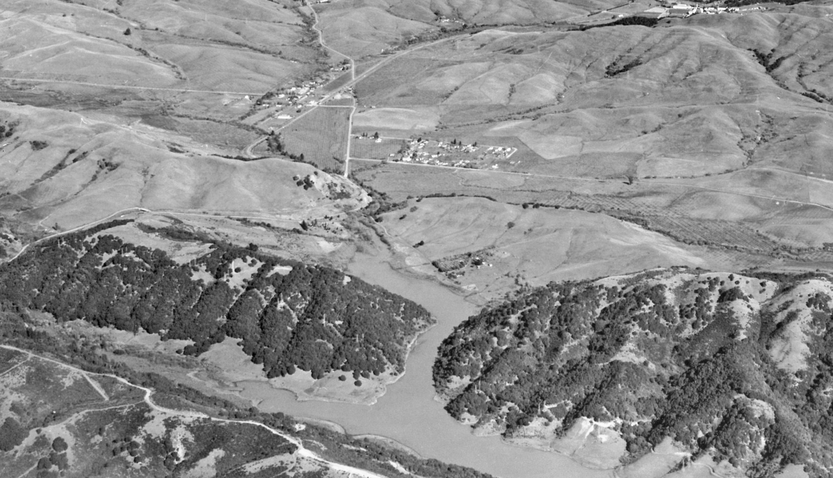
Historic Sacramento Northern Railway near Valle Vista09

Stop 9Valle Vista

A Lost Community

By 1914, James Irvine’s Moraga Company began developing Moraga’s first subdivision in the valley and hills before you. Valle Vista residents boarded electric commuter trains on this spot, headed for Oakland through a tunnel in the Oakland Hills. Development halted when the East Bay Water Company announced plans in 1924 to flood the valley for a source of drinking water.

The resulting 500-acre Upper San Leandro Reservoir sits where the original Valle Vista homes were razed to make way for rising water. Hiking trails along former Valle Vista roadways reveal foundations of the development, offering a glimpse of this lost community.